Geomatics Engineering What is geomatics?

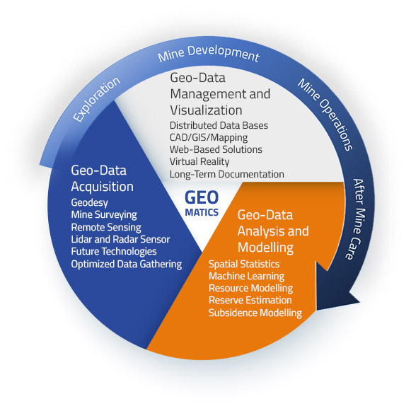
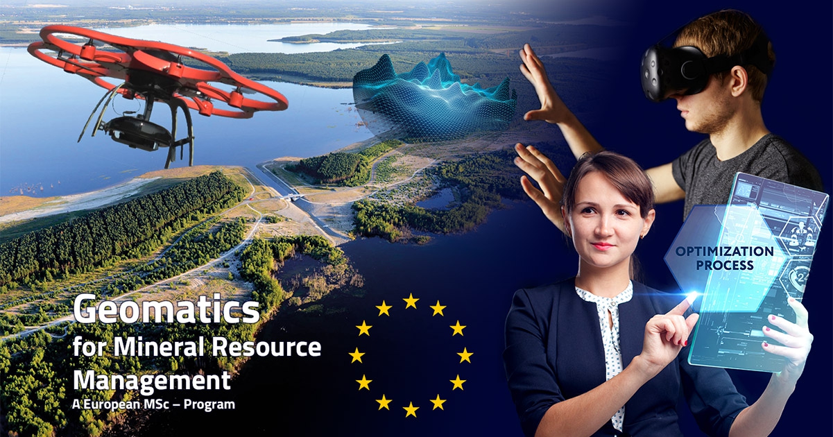
Geomatics is an interdisciplinary field of research that combines aspects of surveying, sensor technology with data processing, geoinformatics and geomodelling.

The main focus of Geomatics lies on the regulation and control of the interplay between resource extraction and its environmental impact.

Exploration, mine development, mine operations, after mine care Why study geomatics?

the content of geomatics

Having excellently trained experts in the field of Geomatics is nowadays more important than ever. The reason for that is the continuously rising global demand for raw materials, which leads to the extraction of mineral resources in areas of the geosphere that are more difficult to access. Simultaneously, the highest levels of safety as well as environmental and social regulations need to be fulfilled, and the optimal use of natural resources by maximizing recovery is desired. This requires engineers to be able to develop new innovative solutions, making the best use of most modern technology to acquire, manage and analyze geodata.
Exploration, mine development, mine operations, after mine care Course Structure

study geomatics the course structure

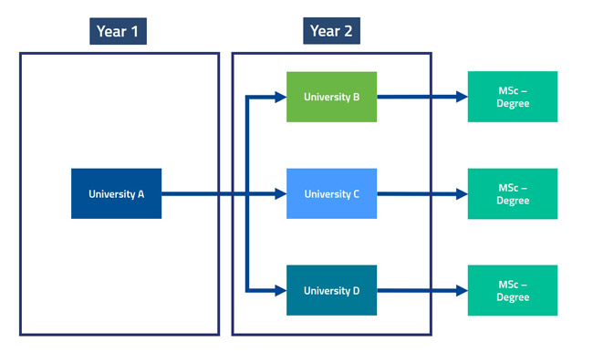
Geomatics for Mineral Resource Management is a European MSc-program which enables students to study at top tier universities for geoscience across Europe. To be precise, this includes Técnico Lisboa, TU Delft, TU Bergakademie Freiberg, Montanuniversität Leoben and the Wroclaw University of Science and Technology. Depending on which university you chose to sign up for Geomatics for Mineral Resource Management, different routes can be chosen. The first year (semester 1 and 2) is always held at the university you signed up. The second year (semester 3 and 4) will be conducted at one of the partner universities, including the M.Sc.-thesis in the 4th semester). The successful completion of this M.Sc.-program will accumulate in a joint degree or double degree (based on the agreement among the two respective universities) between the university from year 1 and the university from year 2 of your studies. For more information about the individual paths, please refer to the information right below.

Técnico Lisboa

Contact:
Dr. Maria João Pereira
Associate Professor
Departamento de Engenharia Civil
Arquitectura e Georrecursos
Instituto Superior Técnico

Email: maria.pereira@tecnico.ulisboa.pt

Start Here

Técnico Lisboa

Contact:
Dr. Maria João Pereira
Associate Professor
Departamento de Engenharia Civil
Arquitectura e Georrecursos
Instituto Superior Técnico

Email: maria.pereira@tecnico.ulisboa.pt

Start Here

TU Bergakademie Freiberg

Contact:
Prof. Dr.-Ing. Jörg Benndorf
Professor for Geomonitoring and Mine Surveying
Institute of Mine Surveying and Geodesy
TU Bergakademie Freiberg

Email: geomatics@mabb.tu-freiberg.de

Geomatics for Mineral Resource Management will be offered for the first time at the TU Bergakademie Freiberg with the start of the winter semester 19/20 (01.10.2019). Here, students have the choice between the two specializations “Geomatics for Mineral Resource Management” and “Mine Surveying”. The second specialization is offered as a joint course between the TU Bergakademie Freiberg and the Montanuniversität Leoben (Austria). Agreements with the other partnered universities are currently under development. Detailed information about the course content, admission requirements and deadline can be found here.

Start Here

Montanuniversität Leoben

Contact:
Dr. Reinfried Pilgram
Associate Professor
Chair of Mining Engineering and Mineral Economics
Montanuniversität Leoben

Email: reinfried.pilgram@unileoben.ac.at

Start Here

Wrocław University of Science and Technology

Contact:
Dr. Jan Blachowski
Deputy Head Geodesy and Geoinformatics Division
Faculty of Geoengineering, Mining and Geology
Wroclaw University of Science and Technology

Email: jan.blachowski@pwr.edu.pl

Geomatics Engineering MOOC’s

In addition to the courses, massive open online courses (MOOC’s) are offered. The MOOC’s consist of a series of web-videos, which cover the content of an individual course. The first video in every series will consist of a short introduction to the topic, explaining the importance of the topic and how it refers to real-life applications. The MOOC’s will be held by internationally leading experts in the respective field of research. As an example of such a MOOC video, the introduction video to the course Geostatistics for Natural Resource Evaluation can be seen here.

Study Geomatics across europe Partnered Univiersities

Students will have the opportunity to study Geomatics for Mineral Resource Managment at one or more of the following universities across Europe:

Logo of Instituto Superior Técnico, Universidade de Lisboa
The logo of the TU Freiberg
The logo of Montanuniversität Leoben
The Logo of Wrocław University of Science and Technology

More infos about studying geomatics Additional Information

Geomatics for Mineral Resource Management is a European MSc-Program which can be studied at one or multiple universities across Europe. The majority of the courses is held in English. Therefore, a proof of English proficiency by means of a recognized language test (e.g. TOEFL) is required. In some cases, additional proof of language proficiency for the respective national language of the country in which the respective university is located might be required. For detailed information about the exact language-/academic requirements, application deadlines as well as the contact information of the individual universities, please refer to the section “course structure” above.